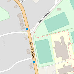
7 SELMESTON ROAD
£417,200
Full Address
Estimated Market Value
£417,200
This estimated value is based upon the latest sale price for the house of £288,000 on 18 Dec 2009. This value is then adjusted by the current Official House Price Index for EAST SUSSEX 1
Is this your house?
Get our free house price tracker.
Local Estate Agents
Add your agency here


| Price Paid | Date |
|---|---|
| £288,000 | 18 Dec 2009 |
| £74,950 | 21 Apr 1995 |
| Detached |
| Freehold |
| Floor Area: 97 sq meters or 1,046 sq feet |
House Price Models
This model uses changes in the Official Land Registry House Price Index for EAST SUSSEX to estimate the market value.
When this house was purchased in December 2009 the House Price Index for EAST SUSSEX was 72.0.
The House Price Index as of 1 Mar 2025 is 104.3 which is a change of 44.861%.Applying this 44.861% change to the original purchase price of £288,000 results in an estimated price of approximately £417,200.
| 18 Dec 2009 | 1 Mar 2025 | % change | Purchase Price | Gain / Loss | Estimated Price |
| 72.0 | 104.3 | 44.861 % | £288,000 | £129,200 | £417,200 |
The Postcode Pricing Model uses changes in average sales price within the BN21 postcode to calculate an estimated price.
The average sales price when the house was purchased is compared with the current average sales price.
This change is then applied to the initial purchase price to derive the current estimated price.
Three different estimates are shown, with averages drawn from 1 month, 3 month and 6 month timeframes.
The longer timeframes give less volatile estimates, but are not so timely.
More information on this model and the calculations
| Change % | Change £ | Estimated Price | |
| 1 Month Average | -17.136 % | £-49,350 | £238,649 |
| 3 Month Average | 45.704 % | £131,627 | £419,627 |
| 6 Month Average | 52.430 % | £150,997 | £438,997 |
| Date | Current Estimated Value | Price Paid | Address |
|---|---|---|---|
| 20 Feb 2025 | £512,868 | £505,000 | 63 ERIDGE ROAD |
| 18 Feb 2025 | £436,699 | £430,000 | 10 SELMESTON ROAD |
| 15 Jan 2025 | £449,126 | £437,500 | 243 KINGS DRIVE |
| 6 Dec 2024 | £335,287 | £325,000 | 43 SELMESTON ROAD |
| 6 Sep 2024 | £582,359 | £555,000 | 245 KINGS DRIVE |
Show these sales on a map
This house has a floor area of 97 sq meters or 1,046 sq feet when measured on 23 Sep 2009.
The average size of a house on SELMESTON ROAD is 79 sq meters (856 sq feet).
| Date | Crime | Outcome | Where |
|---|---|---|---|
| Mar 2025 | Criminal damage and arson | Investigation complete; no suspect identified | On or near Selmeston Road |
| Mar 2025 | Public order | Investigation complete; no suspect identified | On or near Park Avenue |
| Apr 2025 | Violence and sexual offences | Under investigation | On or near King'S Drive |
| Jan 2025 | Anti-social behaviour | On or near Eridge Road | |
| Jan 2025 | Anti-social behaviour | On or near Eridge Road |
View full details of these crimes and others in this area
NATURAL WEALTH LIMITED
61 Eridge Road Eastbourne England BN21 2TSHOPKO HOLDINGS LTD
55 Eridge Road Eastbourne England BN21 2TSDEVONSHIRE BUILDING SOLUTIONS LTD
57 Eridge Road Eastbourne East Sussex United Kingdom BN21 2TSM SHIBOO LTD
43 Eridge Road Eastbourne England BN21 2TSEAST SUSSEX FIBREGLASS LIMITED
40 Selmeston Road Eastbourne England BN21 2SUView more companies near this house
TONY PETER BARRACLOUGH Historic Information OPTICIAN
15 PARK AVENUE, BN21 2XGMr Neil Michael Kirby
64 Park Avenue, BN21 2XSMS HELEN LOUISE ROBERTS
12 COLLEGE GREEN, BN21 2STMISS MUKANZUMA MUNTANGA
26 ERIDGE ROAD, ERIDGE ROAD RODMILL, BN21 2TSAYESHA HAFEDA RAZEKA DURGAHEE Historic Information ASSOCIATE PRODUCER
209 KINGS DRIVE, BN21 2UJMRS LISA ELIZABETH SMART DIRECTOR
213 KINGS DRIVE, BN21 2UJMR RONALD FRANK PIPER Historic Information COACH PAINTER
5 SELMESTON ROAD, BN21 2STMRS JOAN HUGGINS Historic Information
56 PARK AVENUE, HAMPDEN PARK, BN21 2XSMR NICHOLAS ANDREW MANNING Historic Information
40 PARK AVENUE, BN21 2XSNEIL IAN WINFIELD Historic Information PROGRAMME MANAGER
1A TILGATE CLOSE, BN21 2SYMr Simon Jonathan Brooker
3 Averil Gardens, Park Avenue, Eastbourne, BN21 2XGMiss Lesley Dargan Historic Information
11 Park Avenue , BN21 2XGDAVID JOHN ASHTON Historic Information PROFESSIONAL GOLFER
74 PARK AVENUE, BN21 2XSMS CLAIRE WALKER DEVELOPMENT MANAGER
213 KINGS DRIVE, BN21 2UJMR GRAHAM WILLIAM MOLYNEUX Historic Information
42 SELMESTON ROAD, BN21 2SUGABRIELE SORRELL Historic Information DEPUTY HEAD, STATE SCHOOL (RETIRED)
2A SELMESTON ROAD, BN21 2SUMR James David HOPKINS Letting Agent
55 Eridge Road, BN21 2TSMR DAMIEN MARK NICHOLSON DIRECTOR
57 ERIDGE ROAD, BN21 2TSMr Adam Hugh Fairless Historic Information
56 Rangemore Drive , BN21 2TTMR RICHARD JOHN HUGGINS Historic Information DIRECTOR
56 PARK AVENUE, HAMPDEN PARK, BN21 2XSHAZEL MARGARET PHILLIPS Historic Information RETIRED
126 SELMESTON ROAD, BN21 2TLMiss Andrea Secan
117 Selmeston Road, BN21 2TLMS SUSAN VEGA Historic Information RETIRED
213 KINGS DRIVE, BN21 2UJANNE CAFFYN Historic Information DIRECTOR
39 PARK AVENUE, BN21 2XGMr Johannes William Elshof
2a Selmeston Road, BN21 2SUMR JOHN FRANCIS HARRY CLARK Historic Information RETIRED ACCOUNTANT
SHUNA 48 RANGEMORE DRIVE, BN21 2TUSTEPHANIE LOUISE BLAKE Historic Information ACCOUNTANT
61 ERIDGE ROAD, BN21 2TSMR Maksim DENISSOV Electrician
5a Twineham Road, BN21 2TRMr Prakash Joseph Historic Information
117 Selmeston Road, BN21 2TLMr Joseph Prakash Historic Information
117 Selmeston Road , BN21 2TLMR ROGER JOHNSTON RETIRED
1 PARK AVENUE PARK AVENUE, BN21 2XGMrs Bibi Sakhina Brooker
3 Averil Gardens, Park Avenue, Eastbourne, BN21 2XGMr Catalin Farcas
117 Selmeston Road, BN21 2TLMR KEITH CECIL WOODROW Historic Information CONSTRUCTION MANAGER
62 PARK AVENUE, BN21 2XSNICOLE SVE CARTER Historic Information MANAGING DIRECTOR
70 PARK AVENUE, BN21 2XSMS LISA ELIZABETH SMART
213 KINGS DRIVE, BN21 2UJANN LESLEY RICHARDS Historic Information TEACHER
126 SELMESTON ROAD, BN21 2TLMR MUUKAH CHESSTTY MUNTANGA SONOGRAPHER
26 ERIDGE ROAD, BN21 2TSMr Michael James Crawford
35 Park Avenue, BN21 2XGAMIR DAWOOD DURGAHEE Historic Information TRAINEE GRADUATE
209 KINGS DRIVE, BN21 2UJMR MICHAEL JAMES CORNFORD Historic Information COMPANY DIRECTOR
35 PARK AVENUE, RATTON, BN21 2XGMR GRAHAM ALAN SMITH CHARTERED ACCOUNTANT
42 PARK AVENUE, BN21 2XSMR Iain John BROGDEN Information Technology Consult
42 Selmeston Road, BN21 2SUMRS Rosamma PRAKASH Nurse
117 Selmeston Road, BN21 2TLView more people
Price Tracker
- Receive an alert email on any changes which could affect the price of 7 SELMESTON ROAD.
- Alert when a neighbour's house has been sold.
- Warning when burglaries and other crimes occur in the neighbourhood.
- Our email alert is totally free and can be easily canceled at anytime.