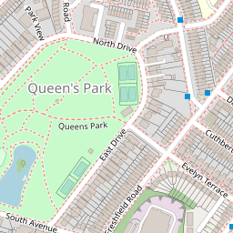
56 QUEENS PARK ROAD
£688,522
Full Address
Estimated Market Value
£688,522
This estimated value is based upon the latest sale price for the house of £387,500 on 28 May 2010. This value is then adjusted by the current Official House Price Index for BRIGHTON AND HOVE 1
Is this your house?
Get our free house price tracker.
Local Estate Agents
Add your agency here


| Price Paid | Date |
|---|---|
| £387,500 | 28 May 2010 |
| Detached |
| Freehold |
| Floor Area: 132 sq meters or 1,420 sq feet |
House Price Models
This model uses changes in the Official Land Registry House Price Index for BRIGHTON AND HOVE to estimate the market value.
When this house was purchased in May 2010 the House Price Index for BRIGHTON AND HOVE was 58.7.
The House Price Index as of 1 Mar 2025 is 104.3 which is a change of 77.683%.Applying this 77.683% change to the original purchase price of £387,500 results in an estimated price of approximately £688,522.
| 28 May 2010 | 1 Mar 2025 | % change | Purchase Price | Gain / Loss | Estimated Price |
| 58.7 | 104.3 | 77.683 % | £387,500 | £301,022 | £688,522 |
The Postcode Pricing Model uses changes in average sales price within the BN2 postcode to calculate an estimated price.
The average sales price when the house was purchased is compared with the current average sales price.
This change is then applied to the initial purchase price to derive the current estimated price.
Three different estimates are shown, with averages drawn from 1 month, 3 month and 6 month timeframes.
The longer timeframes give less volatile estimates, but are not so timely.
More information on this model and the calculations
| Change % | Change £ | Estimated Price | |
| 1 Month Average | 198.660 % | £769,805 | £1,157,305 |
| 3 Month Average | 73.471 % | £284,701 | £672,201 |
| 6 Month Average | 75.826 % | £293,824 | £681,324 |
| Date | Current Estimated Value | Price Paid | Address |
|---|---|---|---|
| 21 Feb 2025 | £299,596 | £295,000 | GROUND FLOOR FLAT 71 QUEENS PARK ROAD |
| 3 Feb 2025 | £431,621 | £425,000 | 2 STANLEY STREET |
| 18 Oct 2024 | £442,832 | £425,000 | 52 STANLEY STREET |
| 12 Oct 2022 | £363,234 | £350,000 | GROUND FLOOR FLAT 57 QUEENS PARK ROAD |
| 15 Jul 2022 | £948,182 | £900,000 | 30 QUEENS PARK ROAD |
Show these sales on a map
This house has a floor area of 132 sq meters or 1,420 sq feet when measured on 11 Dec 2014. Using an estimated price of £688,522 means this house is valued at £5,216 per sq meter (£484 per sq foot).
The average size of a house on QUEENS PARK ROAD is 95 sq meters (1,024 sq feet).
| Date | Crime | Outcome | Where |
|---|---|---|---|
| Mar 2025 | Violence and sexual offences | Action to be taken by another organisation | On or near Stanley Street |
| Mar 2025 | Shoplifting | Investigation complete; no suspect identified | On or near Stanley Street |
| Mar 2025 | Criminal damage and arson | Investigation complete; no suspect identified | On or near Stanley Street |
| Apr 2025 | Burglary | Investigation complete; no suspect identified | On or near West Drive |
| Mar 2025 | Violence and sexual offences | Under investigation | On or near West Drive |
View full details of these crimes and others in this area
LUCY'S ANGELS LIMITED
92 Queens Park Road Brighton East Sussex United Kingdom BN2 0GLSOVEREIGN UNDERWEAR LTD
74 QUEENS PARK ROAD FLAT 3 BRIGHTON ENGLAND BN2 0GL84 QUEENS PARK ROAD (BRIGHTON) LIMITED
84 Queens Park Road Brighton England BN2 0GLBANANA CONSULTING LIMITED
14 QUEENS PARK ROAD BRIGHTON BN2 0GLSATSUMA CONSULTING LIMITED
14 Queens Park Road Brighton United Kingdom BN2 0GLView more companies near this house
EMMA ELIZABETH STIRLING Historic Information
FLAT 1 71 QUEENS PARK ROAD, BN2 0GJRACHEL LINNET JULIA FAWCUS Historic Information EXECUTIVE ASSISTANT
36A QUEENS PARK ROAD, BN2 0GLZOE MELLOR DESIGNER
5 PARK CRESCENT, BN2 0GJMrs Vicky Hatia
31 Queens Park Road, BN2 0GJMRS MARIA DEL ROCIO SANCHEZ ORTIZ ILLUSTRATOR
53B QUEENS PARK ROAD, BN2 0GJMr Jamie Spears
5 Queens Park Road, BN2 0GJCLAIRE CROUCH BAKER Historic Information PAYROLL ASSISTANT
84A QUEENS PARK ROAD, BN2 0GLMr Kai Fiáin
84 Queens Park Road, BN2 0GLMR William Boyd JOHNS Director
92 Queens Park Road, BN2 0GLMS JOANNE MCCARTHY Historic Information BIOMEDICAL SCIENTIST
FIRST FLOOR FLAT, 37 QUEENS PARK ROAD, BN2 0GJMr Fabien Terrasse Historic Information
41 Queens Park Road, BN2 0GJMR FRASER MARTIN HURLEY DIRECTOR
FLAT 1 71 QUEENS PARK ROAD, BN2 0GJMr Michael Anthony Baker
51 Queens Park Road, BN2 0GJMrs Tracy Walker
78 Queens Park Road, BN2 0GLMR JOHN SCARBOROUGH RETIRED
37 FLAT 2, QUEENS PARK ROAD, BN2 0GJDR GARY WILSON TAYLOR PSYCHOLOGIST
5 QUEENS PARK ROAD, BN2 0GJMS ANJA MCCLOSKEY Historic Information MUSICIAN
69 QUEENS PARK ROAD, BN2 0GJMR FABIAN FRANCOIS TERRASSE SELF EMPLOYED
41 QUEENS PARK ROAD, BN2 0GJMRS LUCY ELIZABETH HASWELL Historic Information TEACHER
34A QUEENS PARK ROAD, BN2 0GLTHOMAS PETER BEAMONT Historic Information STUDENT
30 QUEENS PARK ROAD, BN2 0GLMr Riad Ismail Abu-El-Hawa
91 Queens Park Road, Brighton, BN2 0GJANDREA CHILDS DIRECTOR
90 QUEENS PARK ROAD, BN2 0GLDARREN SANDERS Historic Information REGIONAL DELIVERY STANDARDS &
34A QUEENS PARK ROAD, BN2 0GLMichael Osborne ROSE None
22a Basement Flat Queens Park Road, BN2 0GLMRS Jessica Margaret SWETE Managing Director
14 Queens Park Road, BN2 0GLMRS LUCY JANE DUQUENOY Historic Information
84A QUEENS PARK ROAD, BN2 0GLMR ALEX DANIEL JOE STEDALL DIGITAL RETOUCHER
38B QUEENS PARK ROAD, BN2 0GLMRS PATRICIA ANNE GREENWOOD Historic Information RETIRED
GROUND FLOOR FLAT, 57 QUEENS PARK ROAD, BN2 0GJHELEN KATHERINE WILDE Historic Information PSYCHOTHERAPIST
84A QUEENS PARK ROAD, BN2 0GLMISS MARIE NICHOLA COOPER LOSS ADJUSTER
37 QUEENS PARK ROAD FLAT 3, BN2 0GJMRS Alexandra SMART Manager
30 Queens Park Road, BN2 0GLMISS MARGARET MAUD TERESA BATTY Historic Information SCHOOLS COUNSELLOR
FLAT 2 71 QUEENS PARK ROAD, BN2 0GJMR MORRISON FIELD COLE MANAGING DIRECTOR
66 QUEENS PARK ROAD, BN2 0GLMr Christopher King
140 Queens Park Road, BN2 0GJMISS NICOLA JANE HORNE DIRECTOR
88 QUEENS PARK ROAD, BN2 0GLSARAH WIGHTMAN TRAVEL CONSULTANT
34C QUEENS PARK ROAD, BN2 0GLEDWARD JAMES LEVAN
41 QUEENS PARK ROAD, BN2 0GJMS LIANNE SMITH Historic Information SOLICITOR
3 QUEENS PARK LOFTS, QUEENS PARK ROAD, BN2 0GLMS KATHARINE ELIZABETH PIPER Historic Information TEACHER
FLAT 2 37 QUEENS PARK ROAD, BN2 0GJMr Dominic Thomas Alston Jones
31 Queens Park Road, BN2 0GJMRS Shauna Maura CAULFIELD GATES Director
Orchard Day Nursery Queens Park Road, BN2 0GLSUSAN JOY DORIS VIVIAN Historic Information RETIRED
94 QUEENS PARK ROAD, BN2 0GLMR EDWARD SWETE Historic Information COMPANY DIRECTOR
14 QUEENS PARK ROAD, BN2 0GLJULIA ANNE ROBERTS Historic Information PRODUCTION MANAGER
17 QUEENS PARK ROAD, BN2 0GJMISS ELLEN JO THOMPSON PHD RESEARCHER
34 QUEENS PARK ROAD, BN2 0GLMISS Laura CORREA GONZALEZ
57 Queens Park Road, Brighton, BN2 0GJSANDY ONEILL Historic Information OPERATIONS MANAGER
36A QUEENS PARK ROAD, BN2 0GLMr Damian Roger Jopling
31 Queens Park Road , BN20GJSARAH LOUISE PHELAN RETREAT LIASON
20 QUEENS PARK ROAD, BN2 0GLMR Chris Alan DRUMMOND Company Director
85 Queens Park Road, BN2 0GJMR PHILLIP MADIGAN MANAGER
84 QUEENS PARK ROAD, BN2 0GLMR JUDE MATTHEW PEARSON Historic Information MARKETING
BASEMENT 36 QUEENS PARK ROAD, BN2 0GLMR PAUL JOHN GATES DIRECTOR
ORCHARD DAY NURSERY QUEENS PARK ROAD, BN2 0GLMr Vittorio Angelini
31 Queens Park Road, BN2 0GJMRS JESSICA COOTE RETIRED
1ST FLOOR FLAT, 57 QUEENS PARK ROAD, BN2 0GJMrs Rafet Baldry
13 Queen's Park Rd , BN2 0GJMISS CATHERINE MARY TURFREY RETIRED
FLAT 1 GROUND FLOOR 37, QUEENS PARK ROAD, BN2 0GJMR Campbell Thomas James AUSTIN Insurance Salesman
40 Queens Park Road, BN2 0GLJAMES COOMBER Historic Information RETAIL MANAGER
FLAT 1 22 QUEENS PARK ROAD, BN2 0GLMRS RAFET NESE BALDRY
13 QUEENS PARK ROAD, BN2 0GJMr Kasparas Kasparas Galdikas
32a Queens Park Road, BN2 0GLMr Daniel Francis Chezzi
84 Queens Park Road, BN2 0GLView more people
Price Tracker
- Receive an alert email on any changes which could affect the price of 56 QUEENS PARK ROAD.
- Alert when a neighbour's house has been sold.
- Warning when burglaries and other crimes occur in the neighbourhood.
- Our email alert is totally free and can be easily canceled at anytime.