38A DEVONSHIRE AVENUE
£223,876
Full Address
Estimated Market Value
£223,876
This estimated value is based upon the latest sale price for the house of £170,000 on 20 Dec 2017. This value is then adjusted by the current Official House Price Index for SURREY 1
Is this your house?
Get our free house price tracker.
Local Estate Agents
Hockerings Estate Agents
132 Maybury Road, Woking, GU21 5JR
Phone: 01483491034
Add your agency here


| Price Paid | Date |
|---|---|
| £170,000 | 20 Dec 2017 |
| Flats/Maisonettes |
| Leasehold |
| Floor Area: 38 sq meters or 409 sq feet |
House Price Models
This model uses changes in the Official Land Registry House Price Index for SURREY to estimate the market value.
When this house was purchased in December 2017 the House Price Index for SURREY was 79.2.
The House Price Index as of 1 Mar 2025 is 104.3 which is a change of 31.692%.Applying this 31.692% change to the original purchase price of £170,000 results in an estimated price of approximately £223,876.
| 20 Dec 2017 | 1 Mar 2025 | % change | Purchase Price | Gain / Loss | Estimated Price |
| 79.2 | 104.3 | 31.692 % | £170,000 | £53,876 | £223,876 |
The Postcode Pricing Model uses changes in average sales price within the GU21 postcode to calculate an estimated price.
The average sales price when the house was purchased is compared with the current average sales price.
This change is then applied to the initial purchase price to derive the current estimated price.
Three different estimates are shown, with averages drawn from 1 month, 3 month and 6 month timeframes.
The longer timeframes give less volatile estimates, but are not so timely.
More information on this model and the calculations
| Change % | Change £ | Estimated Price | |
| 1 Month Average | -1.275 % | £-2,168 | £167,831 |
| 3 Month Average | 18.619 % | £31,652 | £201,652 |
| 6 Month Average | -4.660 % | £-7,921 | £162,078 |
| Date | Current Estimated Value | Price Paid | Address |
|---|---|---|---|
| 11 Feb 2025 | £385,920 | £380,000 | 119 ALBERT DRIVE |
| 23 Sep 2024 | £478,479 | £456,000 | 163 ALBERT DRIVE |
| 14 Dec 2023 | £354,470 | £330,000 | 8 ST MICHAELS ROAD |
| 31 May 2023 | £440,943 | £416,000 | 54 ST MICHAELS ROAD |
| 18 Mar 2022 | £396,557 | £365,000 | 16 DARTMOUTH GREEN |
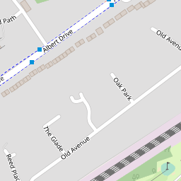
Show these sales on a map
This house has a floor area of 38 sq meters or 409 sq feet when measured on 16 Jun 2017. Using an estimated price of £223,876 means this house is valued at £5,891 per sq meter (£547 per sq foot).
The average size of a house on DEVONSHIRE AVENUE is 74 sq meters (804 sq feet).
| Date | Crime | Outcome | Where |
|---|---|---|---|
| Mar 2025 | Violence and sexual offences | Under investigation | On or near Hennessy Court |
| Feb 2025 | Anti-social behaviour | On or near Hennessy Court | |
| Feb 2025 | Anti-social behaviour | On or near Hennessy Court | |
| Jan 2025 | Violence and sexual offences | Under investigation | On or near Hennessy Court |
| Jan 2025 | Drugs | Local resolution | On or near Hennessy Court |
View full details of these crimes and others in this area
DEVONSHIRE AVENUE RESIDENTS ASSOCIATION LIMITED
93 DEVONSHIRE AVENUE WOKING SURREY ENGLAND GU21 5QJFULGA TRANSPORT LTD
107 DEVONSHIRE AVENUE WOKING ENGLAND GU21 5QJADIVAN DESIGN LTD
97 Devonshire Avenue Woking England GU21 5QJLOCAL HALAL MEAT AND GROCERIES LTD
61-63 Dartmouth Avenue Woking England GU21 5PENEW PAK HALAL LTD
61-63 Dartmouth Avenue Woking England GU21 5PEView more companies near this house
MISS THANDIWE MABODOKO S&T TECHNICIAN
93B DARTMOUTH AVENUE, GU21 5PQMr Ivan Andrianov Lazarov
97 Devonshire Avenue, GU21 5QJMRS Hemali Kaushikkumar AGRAVAL Company Director
19-21 Dartmouth Avenue, GU21 5PEMr Rajab Ali
53 Dartmouth Avenue, GU21 5PEMr Hamad Ali
5 St Lukes Court, Dartmouth Avenue, GU21 5PFMr Bharat Gandobhai Parmar
19/21 Dartmouth Avenue, Sheerwater, GU21 5PEDALE PHILIP GARRAD Historic Information NONE
21 SPENCER CLOSE, GU21 5QHMS PAULETTE JASI Historic Information DIRECTOR
71A DARTMOUTH AVENUE, GU21 5PQMr James Lockewood
24 Devonshire Avenue, GU21 5QLMR LLOYD CHARLES TATHAM Historic Information LOCAL GOVERNMENT OFFICER
46A DEVONSHIRE AVENUE, SHEERWATER, GU21 5QLMr Hakan Soyalp Historic Information
55 Dartmouth Avenue, GU21 5PEMiss Angella Nalule
18b Devonshire Avenue, GU21 5QLMr Asif Ali
53 Dartmouth Avenue, GU21 5PEMR ATTA UL QADIR Historic Information COMPANY DIRECTOR
29 DARTMOUTH AVENUE, GU21 5PEANJUM ZEESHAN Historic Information DIRECTOR
29 DARTMOUTH AVENUE, GU21 5PEMrs Hemali Agrawal
19-21 Dartmouth Avenue, GU21 5PEMr Rashid Irfan
61-63 Dartmouth Avenue, GU21 5PEMr Mihai Balbae
107 Devonshire Avenue, GU21 5QJMr Zahid Hussain
61-63 Dartmouth Avenue, GU21 5PEMR JAMES LOCKE Historic Information LANDSCAPE GARDENING
24 DEVONSHIRE AVENUE DEVONSHIRE AVENUE, GU21 5QLMR KAUSHIK SURESHBHAI AGRAVAL Historic Information COMPANY DIRECTOR
19/21 DARTMOUTH AVENUE, SHEERWATER, GU21 5PEMr Adrian Fulga
107 Devonshire Avenue, GU215QJMRS SAPNA CHAWLA BUSINESSWOMAN
61-63 DARTMOUTH AVENUE, GU21 5PEMR UMESHCHANDRA GANDOBHAI PARMAR Historic Information
19-21 DARTMOUTH AVENUE, SHEERWATER, GU21 5PEANDLEEB AHMED Historic Information NONE
71B DARTMOUTH AVENUE, GU21 5PQView more people
Price Tracker
- Receive an alert email on any changes which could affect the price of 38A DEVONSHIRE AVENUE.
- Alert when a neighbour's house has been sold.
- Warning when burglaries and other crimes occur in the neighbourhood.
- Our email alert is totally free and can be easily canceled at anytime.