1 WHITROUT ROAD
£154,518
Full Address
Estimated Market Value
£154,518
This estimated value is based upon the latest sale price for the house of £32,000 on 14 Dec 1998. This value is then adjusted by the current Official House Price Index for HARTLEPOOL 1
Is this your house?
Get our free house price tracker.
Local Estate Agents
Add your agency here


| Price Paid | Date |
|---|---|
| £32,000 | 14 Dec 1998 |
| Semi-Detached |
| Freehold |
| Floor Area: 72 sq meters or 775 sq feet |
House Price Models
This model uses changes in the Official Land Registry House Price Index for HARTLEPOOL to estimate the market value.
When this house was purchased in December 1998 the House Price Index for HARTLEPOOL was 21.6.
The House Price Index as of 1 Mar 2025 is 104.3 which is a change of 382.870%.Applying this 382.870% change to the original purchase price of £32,000 results in an estimated price of approximately £154,518.
| 14 Dec 1998 | 1 Mar 2025 | % change | Purchase Price | Gain / Loss | Estimated Price |
| 21.6 | 104.3 | 382.870 % | £32,000 | £122,518 | £154,518 |
The Postcode Pricing Model uses changes in average sales price within the TS24 postcode to calculate an estimated price.
The average sales price when the house was purchased is compared with the current average sales price.
This change is then applied to the initial purchase price to derive the current estimated price.
Three different estimates are shown, with averages drawn from 1 month, 3 month and 6 month timeframes.
The longer timeframes give less volatile estimates, but are not so timely.
More information on this model and the calculations
| Change % | Change £ | Estimated Price | |
| 1 Month Average | 224.303 % | £71,776 | £103,776 |
| 3 Month Average | 269.565 % | £86,260 | £118,260 |
| 6 Month Average | 235.836 % | £75,467 | £107,467 |
| Date | Current Estimated Value | Price Paid | Address |
|---|---|---|---|
| 21 Feb 2025 | £81,246 | £80,000 | 35 TEMPEST ROAD |
| 29 Oct 2024 | £114,615 | £110,000 | 25 KING OSWY DRIVE |
| 25 Oct 2024 | £145,353 | £139,500 | 22 TEMPEST ROAD |
| 22 Mar 2024 | £72,594 | £68,000 | 36 LAZENBY ROAD |
| 28 Sep 2023 | £180,744 | £170,000 | 17 WOLSINGHAM ROAD |
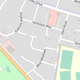
Show these sales on a map
This house has a floor area of 72 sq meters or 775 sq feet when measured on 27 Aug 2013. Using an estimated price of £154,519 means this house is valued at £2,146 per sq meter (£199 per sq foot).
The average size of a house on WHITROUT ROAD is 85 sq meters (915 sq feet).
| Date | Crime | Outcome | Where |
|---|---|---|---|
| Feb 2025 | Drugs | Under investigation | On or near Whitrout Road |
| Feb 2025 | Violence and sexual offences | Investigation complete; no suspect identified | On or near Whitrout Road |
View full details of these crimes and others in this area
BINGHAM SOCIAL CARE LIMITED
47 WHITROUT ROAD HARTLEPOOL CLEVELAND UNITED KINGDOM TS24 9PWLUKE HAND ELECTRICALS LIMITED
43 Whitrout Road Hartlepool England TS24 9PWR.G.K SERVICES LIMITED
6 Hutone Place Hartlepool England TS24 9PTZULCRON SPORTS LTD
29 Goldsmith Avenue Hartlepool England TS24 9PNZULCRON LEISURE LTD
29 Goldsmith Avenue Hartlepool England TS24 9PNView more companies near this house
ROBERT EDWARD HANSON STRICKLAND INDUSRIAL CLEANING CONSULTANT
48 KING OSWY DRIVE, TS24 9PEKEVIN BARRY DIXON DIRECTOR
122 WHIN MEADOWS, TS24 9NXMR JOHN LILLEY WELDER
32 HOWDEN ROAD, TS24 9PYMrs Michelle Dixon Historic Information
122 Whin Meadows, TS24 9NXMrs Baljit Kaur Historic Information
61 King Owsy Drive, TS24 9PFMR GARY KEITH ROBERTS DIRECTOR
11 TEMPEST ROAD, TS24 9QHMr Kristopher Martin Gray Historic Information
34 Howden Road, TS24 9PYRobert Thomas TAYLOR Director
58 King Oswy Drive, TS24 9PEDOROTA DYBA Historic Information HOUSE WIFE
73 HOWDEN ROAD, TS24 9PYDEREK NICHOLSON Historic Information TECHNICAL DIRECTOR
79 WHIN MEADOWS, VICTORIA GARDENS, TS24 9NUMR JONATHAN KENNETH FEWSTER DRIVER
51 WHIN MEADOWS, TS24 9NUMR Robert George KINNERSLEY Rigger
6 Hutone Place, TS24 9PTMr Clive Jordan Historic Information
6 Nicholson Way, TS24 9QNGreg Laidler
5 Ridlington Way, TS24 9QAMr Graeme Vasey
60 King Oswy Drive, TS24 9PEMrs Kelly Bingham
47 Whitrout Road, TS24 9PWMALARZ DANIEL Historic Information MECHANIC
73 HOWDEN ROAD, TS24 9PYMr Safdermasud Alifaizurrehman Saiyed
81 King Oswy Drive, TS24 9PFMr Daniel Martin Oliver Historic Information
49 Howden Road, TS24 9PYMRS AMANDA BYRNE COMPANY DIRECTOR
125 WHIN MEADOWS, TS24 9NXMr Grahame Flounders
2 Whitrout Road, TS24 9PWMr Gary Byrne
125 Whin Meadows, TS24 9NXDEREK PRESTON Historic Information RETIRED
65 HOWDEN ROAD, TS24 9PYMISS GEMMA LINDA PRICE STRUCTURAL SURVEYS
17 HOOD CLOSE, TS24 9PZMr Christopher Mark Kiddle
24 Howden Road Howden Road, TS24 9PYMRS FRANCES THELMA STRICKLAND
48 KING OSWY DRIVE, TS24 9PEPHILIP DAVID ABBEY BRICK CUTTING
101 WHIN MEADOWS, TS24 9NXMISS MELANIE SKINNER COMPANY DIRECTOR
49 KING OSWY DRIVE, TS24 9PDMiss Carly Amanda Sowerby
5 Ridlington Way , TS24 9QAMr Grant Philip Scott Historic Information
49 Whin Meadows, TS24 9NUJOSEPH CAIRNS Historic Information RETIRED
78 KING OSWY DRIVE, TS24 9PEMrs Allyson Margaret Holmes Historic Information
117 Whin Meadows, Victoria Gardens, TS24 9NXMr Stephen Lilley
10 Howden Road, TS24 9PYALAN GARBUTT Historic Information
93 KING OSWY DRIVE, TS24 9PGMISS JULIE KELSEY NONE
11 TEMPEST ROAD, TS24 9QHMRS NAZIYAKHATUN MOMINSUTHAR DIRECTOR
81 KING OSWY DRIVE, TS24 9PFMr Patrick William Holmes Historic Information
117 Whin Meadows, Victoria Gardens, TS24 9NXMr Jason Lee
29 Goldsmith Avenue, TS24 9PNMR MOHAMADIKBAL MOMINSUTHAR DIRECTOR
81 KING OSWY DRIVE, TS24 9PFJORDAN TIERNEY DIRECTOR
12 PERT ROAD, TS24 9PPKevin Barry Dixon Historic Information
122 Whin Meadows, TS24 9NXView more people
Price Tracker
- Receive an alert email on any changes which could affect the price of 1 WHITROUT ROAD.
- Alert when a neighbour's house has been sold.
- Warning when burglaries and other crimes occur in the neighbourhood.
- Our email alert is totally free and can be easily canceled at anytime.